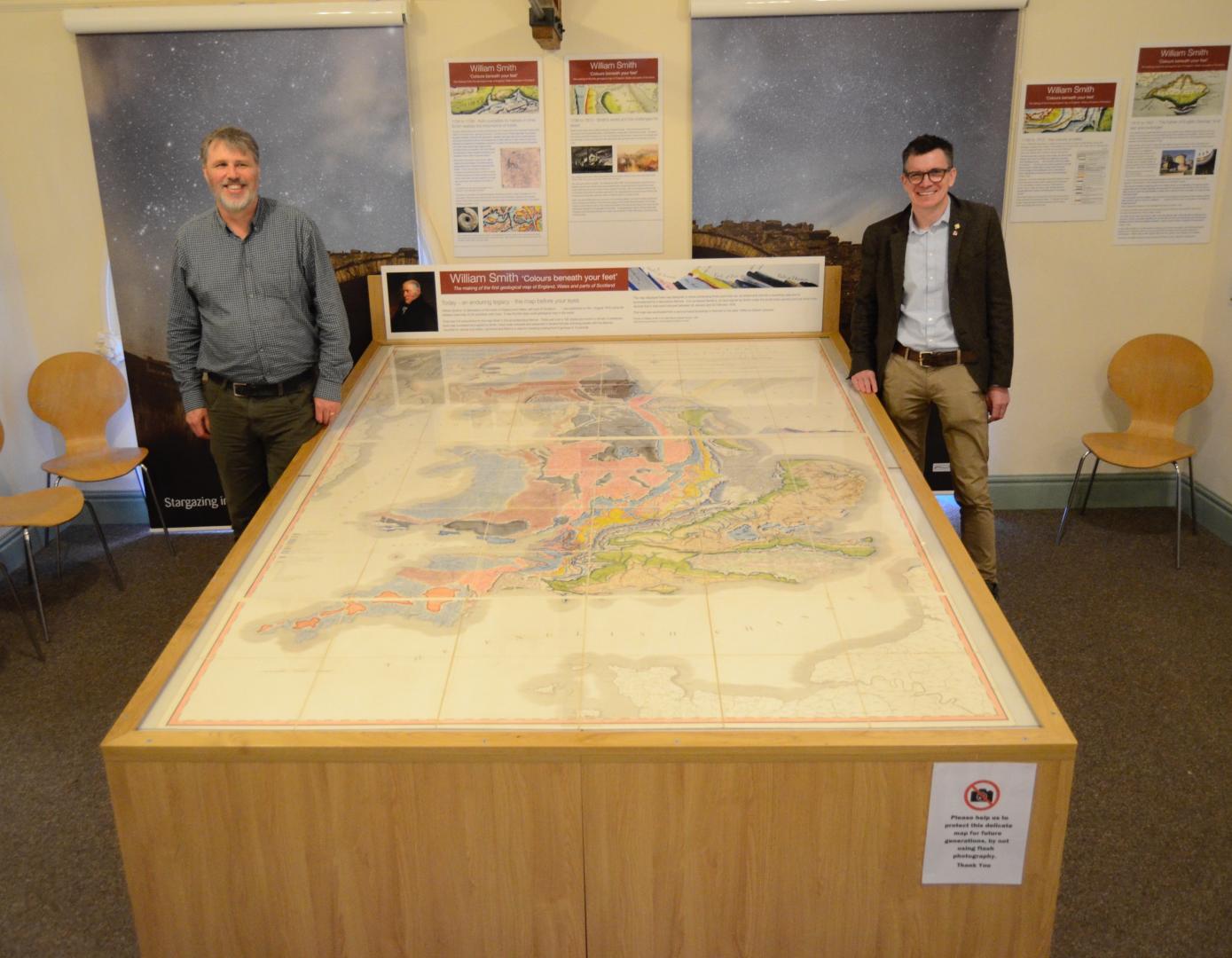
AN exhibition boasting the “map which changed the world” will kick off the summer season at a Teesdale visitor centre.
Bowlees Visitor Centre is displaying an original example of a William Smith’s map of England, Wales and part of Scotland – the world’s first countrywide geological map drawn in 1815.
It is the centrepiece of a wider display on geological mapping launched at the North Pennines AONB hub this month as part of the Heritage Lottery funded Earthworks project.
Known as “the father of English geology” , William Smith produced the world’s first countrywide geological map after years of graft and measurement travelling by coach, horse and on foot.
Smith’s techniques and map colours are still used by geologists all over the world and visitors have a chance to see his 19th century handiwork alongside an interactive audio-visual display and other maps of Teesdale and County Durham.
Natural England geologist Jonathan Larwood is the owner of the rare Smith map which is carefully carried around the country in a bespoke case.
Mr Larwood said: “Smith’s map is an important piece of national scientific heritage and it is great to see it travelling to the North Pennines.
“The exhibition charts Smith’s process for creating the map but also tells the human story behind it of Smith’s remarkable rise from humble beginnings to renowned geologist.”
The Lottery funding for the Earthworks project will
also give greater support to the North Pennines’ UNE-SCO Global Geopark designation.
The designation means the area’s unique geology is heralded as important worldwide and puts it alongside one of only four UNESCO designations in the North East and Cumbria.
Chris Woodley-Stewart, North Pennines AONB Partnership director, said: “Bringing this William Smith map to the North Pennines is an important first stage in our Earthworks project.
“Earthworks will help us to bring this area’s geological heritage to life and we are looking forward to telling the North Pennines’ fascinating story of ancient tropical seas, vast deserts, moving continents, huge ice sheets, magma and minerals.
“We’re grateful to the Heritage Lottery Fund and to National Lottery players for supporting this geo-heritage project and helping us to develop education, the visitor economy and local people’s enjoyment of the area.”
Ivor Crowther, head of the Heritage Lottery Fund North East, said: “It is great to see that the Earthworks project is launching with such a prestigious piece of scientific history in the form of the William Smith map.
“We are delighted to be supporting the North Pennines AONB Partnership to help people to connect with the geological heritage of this fascinating area.”
Admission to the exhibition is free and it runs until Sunday, June 10. To find out more, contact Bowlees Visitor Centre on 01833 622145.


